
It was a derecho, or something like one. The gust front you see in the third image here —
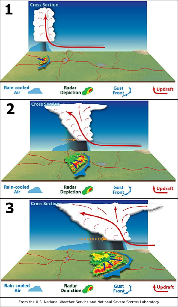
—looks a lot like the storm front in the top image above (via Weatherbug, storm tracker view). I’d experienced one twelve years ago, in Arlington, Mass. It felt like a two minute hurricane, and when it was over, hundreds of trees were down. This one wasn’t as bad, but TwitteX seemed to agree that it was a derecho. And we did have many broken trees and power outages. Here’s one example of the former:

That’s half a huge silver maple. Very luckily, it missed the house and only trashed the metal fence. Pretty house, too.
There was also a lot of lightning as well. Dig:
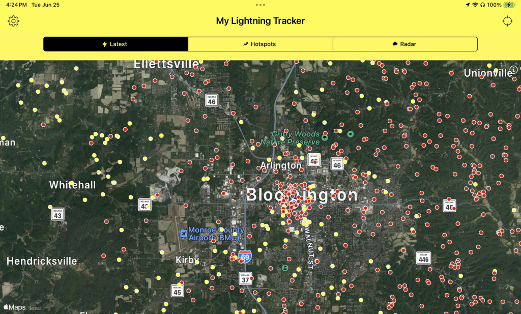
You can barely see the blue dot in the middle, but that’s where we live. One of those red dots is about a hundred feet from where I’m writing this.
If you’re into this kind of stuff, I recommend the My Lightning Finder app, which produced the above. Also LightningMaps.org on the Web. That one shows thunder as gray circles expanding and fading at the speed of sound moving outward from a lightning dot. Of course, lots of those lightning dots are lines in clouds, or zig-zags between ground and sky. They aren’t all “strikes.”
But when lightning does strike, one of my favorite storm sounds is a loud crack, then “Cccchhhheeeeeooooowwwwwww” before a BOOM of thunder slams the ground. What you’re hearing after the crack is sound coming off the length of the lightning strike, starting at the ground and moving up to the cloud above. The volume of the sound and its pitch go down as they originate from farther and farther away along the length of the lightning bolt itself. The BOOM is produced by the top of the bolt, which typically fans out inside the cloud, parallel to the ground, in a shape that looks something like the letter T, with the top crossbar parallel to the ground. The BOOM comes at you from the top of the bolt. Listen for the whole show the next time you’re in a storm and lightning strikes nearby.
[Later, 1:00 am on 27 June…] Much of the city is still without power. Also, this photo on Reddit, shot from the west side Aldi, shows the kind of rain that produces a derecho.
Also, from the Monroe County Emergency Management Storm Update 1 p.m. on 6/27/24:
More than 100 damage reports have been collected by Indiana 211 following Tuesday’s storm event in Monroe County. The National Weather Service confirmed straight-line winds of 65-75 mph damaged homes and property in Monroe, Owen, Vigo and Clay counties. All four counties have declared, or plan to declare, local disasters due to the incident. No reports of significant injuries have been received at this point. Impacted residents in these four counties are asked to call 211 to report damage or visit the website at https://in211.org.
Damage
Most of these reports involve overturned trees into homes, some with significant damage. Only a handful of residents reported their homes to be uninhabitable. The local Salvation Army reported only two residents utilized the shelter established at their location, 111 N. Rogers St… As of 1 p.m. Thursday, approximately 28,000 power outages were reported across Indiana, with nearly 16,000 of those reported in Monroe County.
Thanks to Dave Askins of the B Square Bulletin for that one.
Leave a Reply